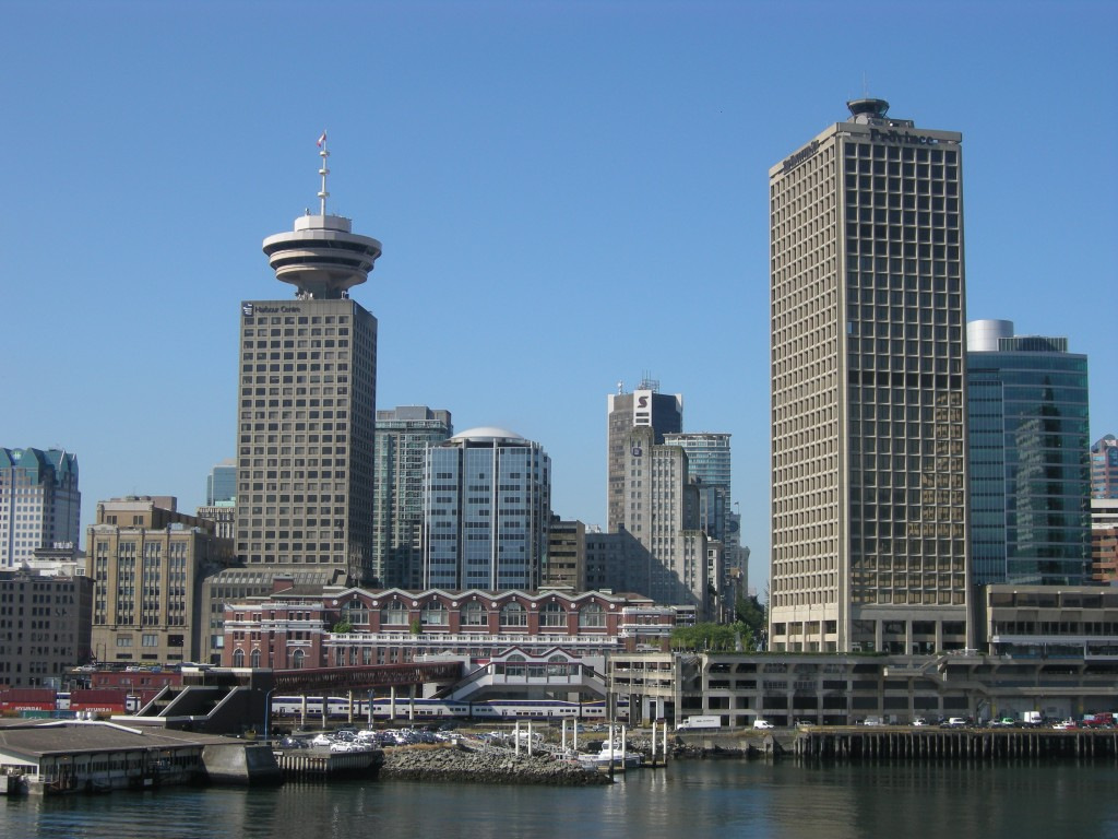
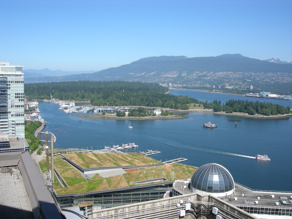
YHC – the world’s highest ATC Tower on top of the 30-storey building at the right.
Written for Airwaysmag.com/Airchive.com
OK, fellow AvGeeks, here’s your quiz for the day.
Name an airport that’s located in a major North American city, and has scheduled airline service. Easy? Sure. How about one that doesn’t have any runways? And has the world’s highest control tower, uses something other than radar to keep an eye on traffic, and even has instrument approaches that aircraft use when the weather is down. Not possible? Think again…
I’ve just described Vancouver Harbour Tower and Water Airport. (CYHC)
You may have been fortunate to visit Vancouver, perhaps to take an Alaska cruise, or watched some of the 2010 Winter Olympics on TV. If so, you likely saw aircraft, seaplane and helicopter traffic in and around the harbour. Lots of traffic. In 2012, over 54,000 aircraft landed or took off. Mainly fixed-wing but with almost 9,000 helicopter operations. Another 21,000 aircraft just flew through the Control Zone (CZ).
YHC’s tower is located on top of the 30 storey building at 200 Granville St, right on the harbour. The tower cab was commissioned in 1978, and holds the distinction of being the world’s highest ATC tower at 142 meters, or 465 feet above the ground. There are some pretty high free-standing control towers elsewhere in the world, such as the 132.2 meter tower at Suvarnabhumi Airport (VTBS/BKK) in Bangkok, Thailand. A new 136-meter-high control tower under construction at King Abdulaziz International Airport (OEJN/JED) in Jeddah, Saudi Arabia, will claim the record for the world’s tallest free-standing control tower when it is completed next year. That’s impressive, but it still won’t be as high as YHC’s.
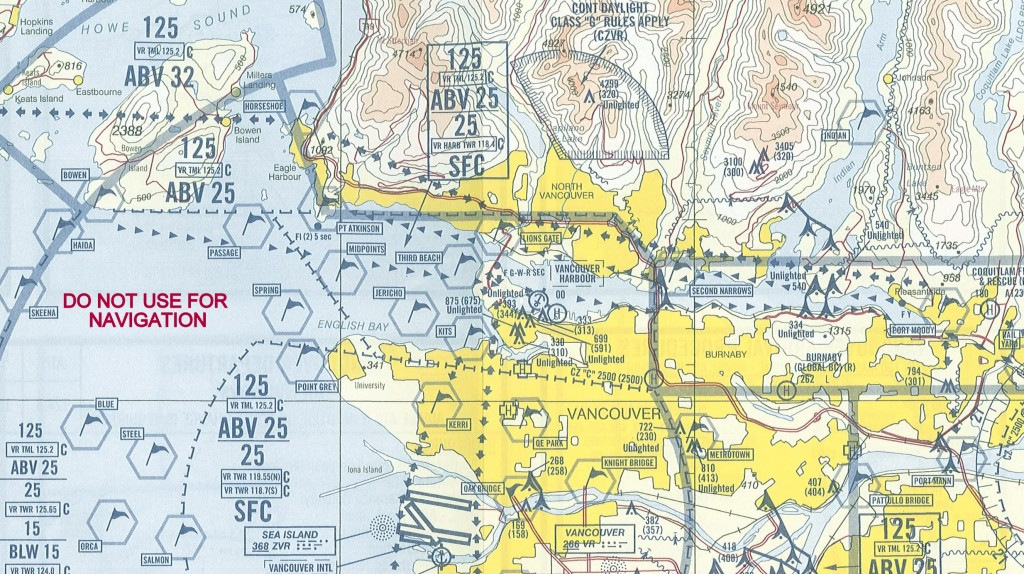
Vancouver Visual Flight Rules Terminal Area (VTA) Chart – VHC’s CZ is in the middle of the image
Courtesy: Dave Weston | Nav Canada
Have a look at above section of the Vancouver Visual Flight Rules (VFR) Terminal Area Chart. Vancouver Harbour Tower “owns” the airspace from a couple of kilometers north of Vancouver International Airport (CYVR), up to the North Shore Mountains. The zone is about 15 km (9 miles) east-west, centred on Vancouver’s famous Stanley Park. You can see hash marks around the zone. Vertically, you’re in YHC’s CZ from the surface up to 2,500 feet. Above that, you’re talking to Vancouver Terminal – Air Traffic Control. (ATC) The flags on the chart are “reporting points” for pilots, and you can see YVR’s runways near the bottom.
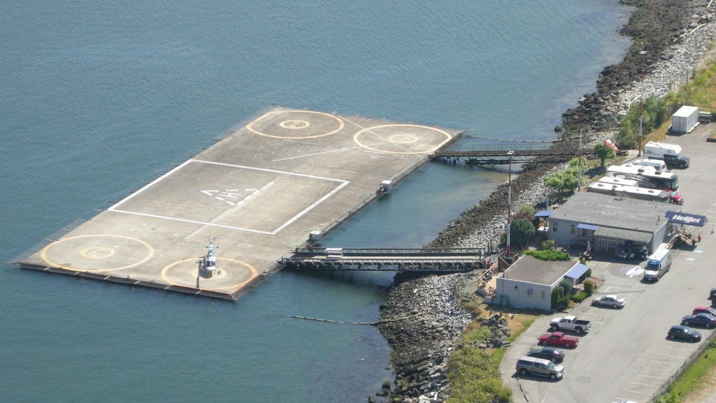
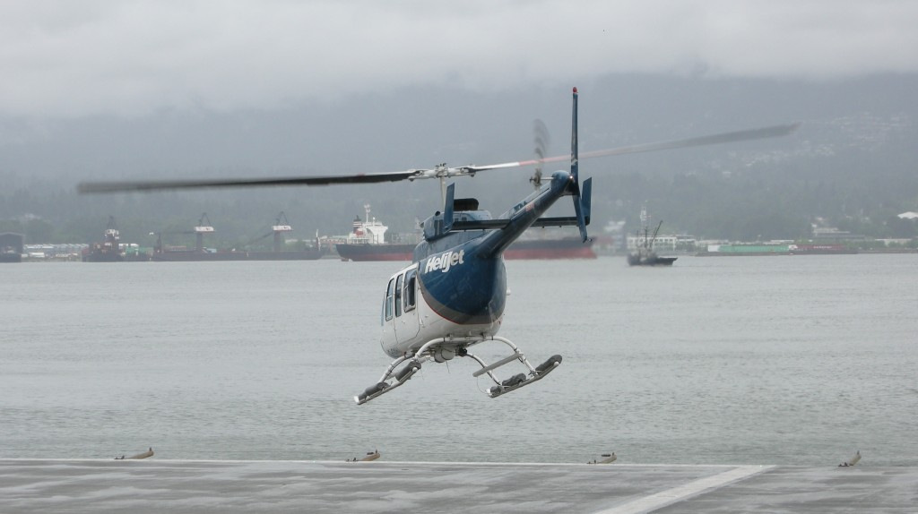
Vancouver Harbour Heliport, seen from the YHC tower.
That’s a Helijet Bell LongRanger waiting to depart.
Nav Canada operates YHC, and it includes two air terminals. Helijet operates the Vancouver Harbour Heliport, located on the shore just east of the control tower. Helijet flies 12-seat, Sikorsky S-76 and 4-seat Bell LongRanger helicopters on regular service between the Vancouver Heliport and the Heliport in Victoria, BC’s capital city on Vancouver Island. The S-76’s are equipped for flight under Instrument Flight Rules (IFR) conditions, and can fly approaches when the weather is down. The helipad has one landing zone, with 4 parking pads. Transient helicopter traffic also uses the Heliport.
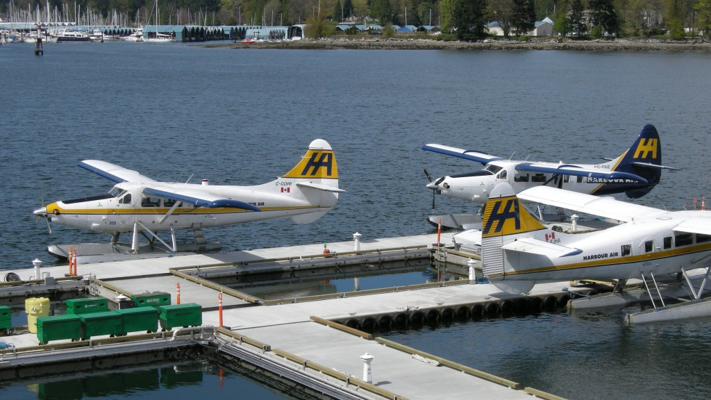
ancouver Harbour Floatplane Terminal. You can see a mix of DHC Turbine Otters, Twin Otters and Beavers.
To the west of YHC’s tower is the Vancouver Harbour Seaplane Terminal. It’s located on the water side of Vancouver’s new Convention Centre, right below the 2010 Olympic Flame. The biggest airline is the Harbour Air group, which includes Harbour Air, West Coast Air and Whistler Air. They have high-frequency scheduled service to Victoria’s and Nanaimo’s harbours. They also fly to many other destinations on BC’s West Coast and to Green Lake, near Whistler. Other airlines include Seair Seaplanes, Salt Spring Air, and Tofino Air, all serving coastal and island communities. You’ll see a mix of floatplanes at the terminal. The majority are deHavilland Canada’s finest – round-engined DHC-2 Beavers, DHC-3T Turbine-converted Otters, and what I think is the world’s best floatplane, the twin-turboprop DHC-6 Twin Otter. Other types include Cessna piston singles, like the C-180/185 and C-206, and the PT-6 turboprop powered Cessna Caravan. Some planes are on amphibious floats, which have retractable wheels, but most are on non-wheeled “straight” floats.
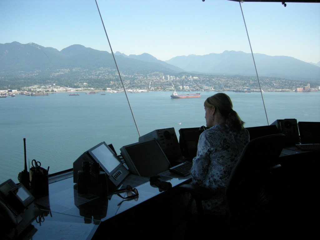
Kim Marshall working YHC’s air traffic, on a gorgeous summer day.
If you look carefully, you can see a floatplane about to touch down, just above Kim’s monitors.
The folks at Nav Canada arranged a tower visit for me, and it was on a spectacularly beautiful summer day. I was welcomed by Dave Weston, the facility’s Unit Operations Specialist and Supervisor of the team that staffs the tower. I also met Kim Marshall, who was the on-duty Controller handling the traffic.
So if YHC doesn’t have runways, taxiways or a ramp, how do ATC operations work?
At “land” airports, ground controllers handle the movement of aircraft and vehicle traffic on the airport from the ramp, on the taxiways, to or from the runway in use. Tower controllers are responsible for operations on the active runway, and “clear” aircraft for departure and landing. They also control the airspace directly around the airport.
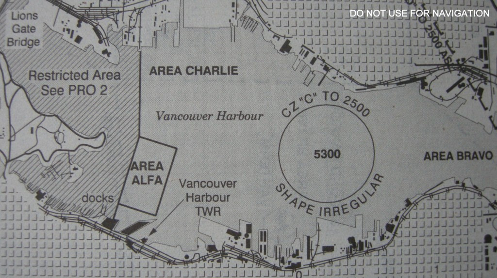
YHC’s floatplane operations areas in Vancouver Harbour
Courtesy: Dave Weston | Nav Canada
Instead of runways, YHC has 3 areas designated for floatplane takeoffs and landings – Areas Alfa, Bravo and Charlie. Area Alfa is the closest to the terminals, and gets virtually all of the use. There’s a bit of unique terminology that’s used for floatplane communications, too. Instead of pilots saying that they’re “rolling” for takeoff on a runway, floatplanes are “on the slide” when they’re taking off.
Departing and arriving traffic is routed to take off and land into the wind. Controllers take into consideration local obstacles, buildings and squirrelly air flow over Stanley Park’s trees when giving instructions to pilots. Of course, final responsibility for the safe operation of the aircraft, as always, rests with the pilot-in-command.
A bunch of years ago I learned how to fly floatplanes. The flying part is easy, much like any other plane. I’m sure other float pilots out there will agree that the real challenge is manoeuvering on the water. The plane becomes a boat, with the rudder hanging out in the breeze. You’ve got little water rudders that drop down from the back end of the floats. The wind, currents and waves can make the taxi to and from the dock…fun. It’s a sailboat, and not a particularly good one. And, as far as maritime law is concerned, a floatplane is a watercraft unless it’s flying. It’s governed by maritime rules when it’s on the water.
Harbour Air DHC-3T Turbine Otters at the YHC floatplane dock.
Now think about getting to and from the dock on a nice, summer afternoon when the harbour is filled with watercraft. Pilots not only have to worry about the safe operation of their plane, but they also have to deal with all of that marine traffic that is in the area. YHC’s controllers aren’t like their land-based counterparts, and don’t issue instructions to pilots for movement to and from the terminal. Controllers aren’t talking to the watercraft, which could be anything from a kayak to a cruise ship, so they certainly don’t have total control over the area. Instead, with their birds-eye view, the controllers “suggest” water manoeuvers to the pilots. With their years of experience, controllers and pilots keep harbour operations incredibly safe.
It’s a whole lot easier for the helicopters coming and going from the Heliport. They stay in the air until just before touchdown, and lift off right from the pad. There’s no particular conflict with watercraft, unless a huge container carrier or cruise ship is in their departure or arrival path. Then they either wait, or avoid the ship.
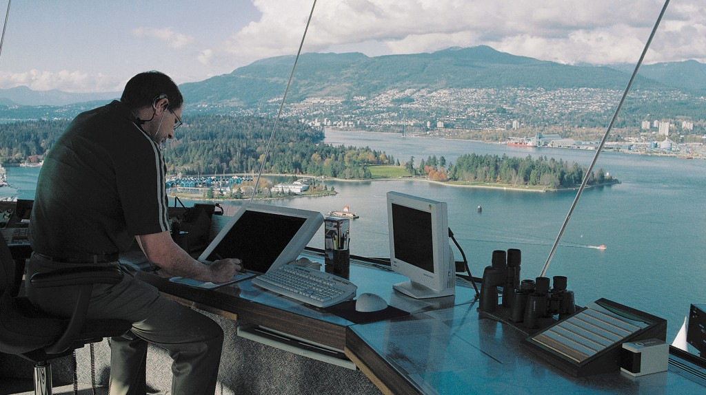
What a view!!! That’s Stanley Park, just above the monitors.
Photo: Nav Canada
The tower is laid out with two controller positions, which both have the same monitoring equipment. When the workload is light, one controller can handle the operation. The second position is staffed when things get busy. Departing pilots make initial contact on the frequency designated as “Clearance Delivery”. That’s a position used at most busy airports, and pilots tell the controller what they’re planning for the flight – where they’re going, what altitude, and flight number if it’s a scheduled flight. There isn’t a “ground” frequency at YHC because, well, there isn’t any ground!
The Controller enters the flight’s info into the Extended Computer Display System (EXCDS), also known as “NavCan Strips.” That’s a real-time flight coordination system that helps controllers manage flight data electronically, using touch sensitive display screens instead of the paper strips you might have seen in old movies. With EXCDS, flights can be “handed off” to controllers handling adjacent CZs quickly and simply.
Once the floatplane is in motion, the controller gives the pilot wind and weather info along with the takeoff direction and section of Area Alfa in use. If necessary, they’ll also provide the pilot with “suggestions” to avoid other traffic. Pilots switch over to “tower” frequency, the flight is cleared for takeoff, and the pilot advises when they’re “on the slide.” Then then passengers get to enjoy the gorgeous views!
West Coast Air DHC-6 Twin Otter on approach, on a cloudy day.
The weather isn’t always beautiful in Vancouver, though. It does get rainy and cloudy. But flights still have to operate to and from YHC. The scheduled-flight floatplanes all fly under Visual Flight Rules (YVR) operations. That means that that pilots must have visual contact with the ground or water, along with specified horizontal visibility and distance from clouds. The airlines have their own “hard” limits, too. It’s always about safety. So if the base of the clouds isn’t right to the water, the floatplanes can usually fly.
Helicopter pilots actually have a GPS-based Instrument Flight Rules (IFR) approach they can use when the clouds roll in. Helijet pioneered the approach using their IFR-equipped Sikorsky S-76s. The pilots fly a specific path and descent into the YHC CZ from the west. The ‘copter slows down to no more than 90 knots from its cruising speed of around 150 knots, in the case of the S-76. As with all Instrument Approaches, this one has a Decision Height (DH). That’s the altitude where the pilots must see the runway or they have to fly a “missed approach.” Then they either try again or go to an airport with better weather conditions.
Helijet Bell LongRanger lifts off from the Vancouver Harbour Heliport on a cloudy day.
In the case of the YHC IFR approach, there isn’t a runway to look for at the DH. So the ‘copter flies to a geographically-defined “point-in-space”, which happens to be a bit west of Stanley Park. The DH for the approach is 600 feet. If they can see the ground and the harbour at the DH, they can continue on to land at the Heliport. If not, they go “missed.”
In good weather and bad, the Controllers use a nifty display in the tower that helps keep track of all of the aircraft in the zone, and beyond. It’s called the “Nav Canada Auxilliary Radar Display System,” or NARDS. Here’s a screen grab from NARDS:
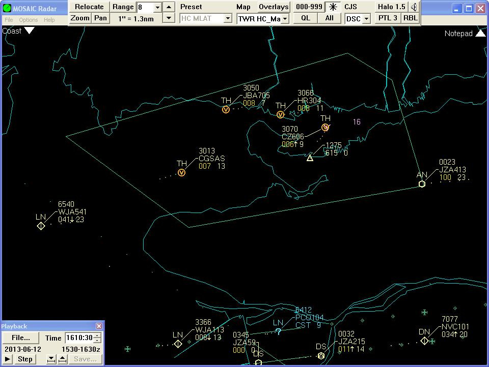
Nav Canada Auxilliary Radar Display System – NARDS.
Courtesy: Dave Weston | Nav Canada
You can see the flights in the YHC CZ, all with little “V”s. That means that the planes are flying VFR. They’re being controlled by “TH”, or “Tower Harbour.” You can also see other traffic in the area, especially around YVR to the south. You can see the flight number, such as “HR304” or the plane’s registration, “C-GSAS.” The flight’s altitude is displayed just below. For example, C-GSAS is showing “007”. Just add 2 zeros, and you get 700 feet. Add one zero to the number just to the right, and you get the aircraft’s speed. “13” becomes 130, in knots. There’s also direction and altitude change info on the “blips.”
But hang on, there’s a triangle on the harbour. It’s showing “615” for the altitude, add two zeros – 61,500 feet!? What the heck is that? It’s YHC’s location, and it’s also the test signal for some advanced technology installed in the YHC CZ. The system is called Wide Area Multilateration, or WAM. Dave and his crew just call it MLAT. It keeps track of aircraft in the CZ, and isn’t a radar system.
OK, I’ll explain, stay with me for a bit…
We’ve all seen radar dishes at airports or on boats. They spin around, some really fast, but ATC radars usually take about 5 seconds to go around. As the dish spins it sends out a narrow beam of microwaves. That beam bounces off a target, like a plane, and returns to the dish. Processing equipment can then calculate the position of the target, which is seen on a controller’s display. Radar is the primarily technology used by ATC to “see” aircraft”
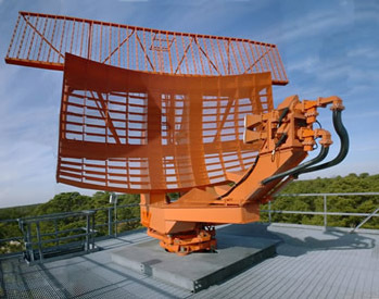
Primary & Secondary ATC Radar Dish
Photo: FAA
But it’s really old technology, invented in World War II. It’s been updated over the years, of course, for both civilian and military use. Decades ago, “Secondary Surveillance Radar” was added to the primary radar system. When you look at a dish at an airport, the SSR antenna is the long rectangle just above, and spinning with the main dish. It’s also WWII technology, used to figure out who were the good guys and who were the bad guys. It was called IFF, for “Identification, Friend or Foe,” and code-named “Parrot.”
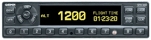
Garmin GTX 330 Transponder
Photo: Garmin
The SSR system “interrogates” an avionics unit installed in the aircraft, called a transponder. The transponder augments the radar return to the dish with a 4-digit pilot-selectable code, along with the aircraft’s altitude information. That kind of transponder is called a “Mode C” unit, and is required equipment if a pilot wants to fly into most any CZ, everywhere.
When the transponder is working, it’s “squawking” – get it? Parrot? So a controller might ask a pilot to “Squawk 2437”. The pilot selects “2437” on the transponder and controller sees a “2437” beside the aircraft’s “blip” on their display. Or the request might be “Squawk Ident”. If so, the pilot presses the “Ident” button on the transponder, and the “blip” might flash or otherwise be identified on the controller’s display.
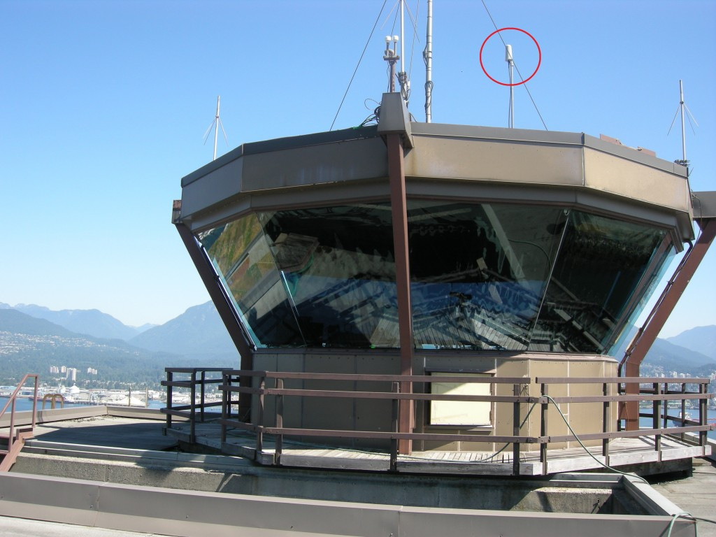
YHC’s Tower Cab – I’ve circled the compact MLAT antenna in red.
But radar has limitations, like most tech. It’s line of sight, and can’t see through buildings or around terrain. There’s only one dish, and it’s never good to have a potential single point of failure, especially with planes flying around. It’s old tech, and that’s why Nav Canada decided to install MLAT in Vancouver Harbour.
Instead of one dish, the MLAT install for YHC has 11 units, located all around the CZ. Each unit is fully solid-state, and really compact. The units can be located on cell towers, on buildings, wherever it’s necessary. Each unit monitors a piece of the control zone, and there’s full coverage right down to sea level.
MLAT interrogates the transponders in aircraft, just like radar. But MLAT gets data from multiple units at the same time, not just from one spinning dish. Each MLAT unit sends out a signal, which bounces back from the target with the Mode C info. For each unit, the precise location of the target can then be determined to be a specific distance away on a calculated arc. MLAT then takes the target data from a bunch of the units, plots the intersection of the arcs, and voilà, the aircraft is located within a few meters accuracy. Simple geometry, but it needs lots of processing power.
The system updates position information every half-second. But NARDS also integrates radar info from YVR, which only updates every 5 seconds. So the MLAT info shown on NARDS updates at the same 5 second rate to keep NARDS happy and not overloaded. Go back and have a look at the NARDS display – all the traffic info in YHC’s CZ is coming to the display via MLAT.
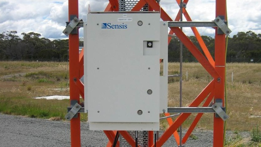
MLAT Processor – it’s only about 3 feet high.
Photo: Saab Sensis
MLAT just…works. Dave was really happy to tell me that “the only moving part in MLAT is the cooling fan in the processor.” Nothing else mechanical, and the system requires minimum maintenance. NavCanada’s MLAT system is made by Saab Sensis, and has been deployed in many other locations in Canada and worldwide. The Vancouver MLAT installation will soon be expanded to improve ATC coverage in the region. No new radar systems. Makes sense!
Oh, yah – the triangle!?? It’s an MLAT test signal that Dave calls the “Parrot”. It’s there so that controllers can confirm the system is operating properly. The Parrot is set to 61,500 feet to avoid confusion with legitimate traffic. Hmmm…how high does the Global Hawk fly? And, for those fellow Techno-AvGeeks out there – yes, I know that the future of ATC includes the ADS-B system, but that’s for another story!
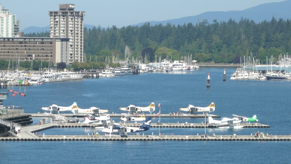
View from YHC’s tower. You can see the floatplane terminal,
just behind the “green” roof of the Vancouver Convention Centre.
So, if you happen to be visiting Vancouver and hanging out in the harbour, look waaaay up and wave to Dave, Kim and the crew in the tower cab at YHC. If they’re not busy handling traffic they might see you, but they’re probably enjoying the best view in the city!
Written for Airchive.com/AirwaysNews